CATIE's digital platform allows monthly monitoring of drought in Central America
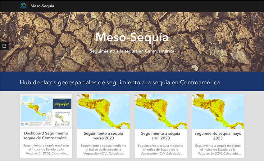
- Through the Meso-drought hub, CATIE collects and provides existing drought data to Central American countries, aiming to enhance the understanding of climate processes in the region.
June 26, 2023. Drought is a transient climate anomaly that occurs periodically in Central America and is occasionally exacerbated by the presence of the El Niño phenomenon. Monitoring drought is crucial for managing biodiversity and agricultural systems in the region.
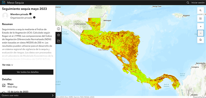
Acknowledging this importance, the Ecosystem Modeling Laboratory of CATIE's Climate Action Unit (Tropical Agricultural Research and Higher Education Center) has made the Meso-drought hub, information center available to all Central American countries. This platform tracks drought using the Vegetation Condition Index (VCI).
Lenin Corrales, researcher at CATIE's Climate Action Unit, explained that the drought hub, is generated from publicly available geospatial data collected by a sensor called MODIS. The laboratory processes this information and publishes a monthly report on the drought status based on the VCI. This indicator measures vegetation stress due to factors such as moisture levels in trees, plants, and crops like corn and coffee.
What is the purpose of the platform?
Corrales stated that CATIE is making an effort to disseminate existing data to gain a better understanding of Central America's climate processes and make informed decisions for the benefit of communities.
"We are building this service to be used for planning, identifying the driest regions within each country of the region, and thus providing more accurate and effective risk management for vulnerable populations," explained the researcher.
Meso-drought allows users to access reports on drought conditions in Central America for the months of March, April, and May 2023. The results can be used to develop a regional drought monitoring and risk assessment system.
In the future, it is expected that the data will enable annual comparisons and establish relationships between drought and other factors, such as forest fires or areas where water harvesting actions are most urgently needed.
"For example, we will be able to identify the driest sites in Central American countries. However, even at this stage, some locations in the border region between Guatemala, El Salvador, and Honduras, known as the Trifinio, are already drawing attention," added Corrales.
Climate literacy
According to Corrales, drought has always been part of the Central American region. Therefore, it is crucial for citizens to understand and educate themselves about the climate in which they live.
"To adapt, we need information, which is why we are interested in generating these types of resources to begin educating the population. We need to become 'climate literate' to understand that everything is recurrent, and more intense processes are yet to come," urged Corrales.
To access the free digital platform and track drought in Central America, visit https://meso-sequia-geocatie.hub.arcgis.com/.
More information:
Lenin Corrales
Senior Researcher
Climate Action Unit
CATIE
lenin.corrales@catie.ac.cr
Written by:
Karla Salazar Leiva
Communications Officer
Information Technology and Communication
CATIE
karla.salazar@catie.ac.cr
Tag:Guatemala, nutrición, Food security

